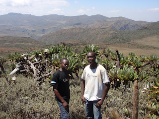
For these reasons, my fellow teacher, Kennedy, and I decided to climb this unusual mountain.
The Uganda/Kenya border goes right through the middle of the Mt. Elgon National Park. This means about half of the peaks are on the Kenya side, and half of the other peaks are on the Uganda side.
Here is our climb in pictures:
Kennedy at one of the ancient, massive trees close to the base of the mountain. The trees get smaller as you go up.
After two days of hiking (about 35 kilometers) we finally see our first view of our final peak!
Our peak is getting closer!
Kennedy on break before the final push.
Looking back on our trekking. The picture makes it look less steep than it really is...
One of the creeks fed by the hot springs flowing from the top of the mountain.
A look from the final ascent.
The very top of the peak. It might not look like it, but there is no way that we could have climbed to the top without equipment. The guy with me is our "porter."
A look into Uganda--also, the valley is part of the Caldera
Between these guys and the peak off in the distance is the Caldera.
Relaxing at the top
Endebess Cliff - a cliff we saw on our way down the mountain
Another view of Endebess Cliff
A giraffe close to the base of the mountain. We saw a lot of animals, but none this close! All the others ran away as soon as they saw us.
At the end of the trip, Kennedy and I both agreed that we had a terrific time, even if hiking 80 kilometers with over 50 pounds on our back made the trekking arduous (and made our legs incredibly sore).


No comments:
Post a Comment